
ዛንታና — Our Story
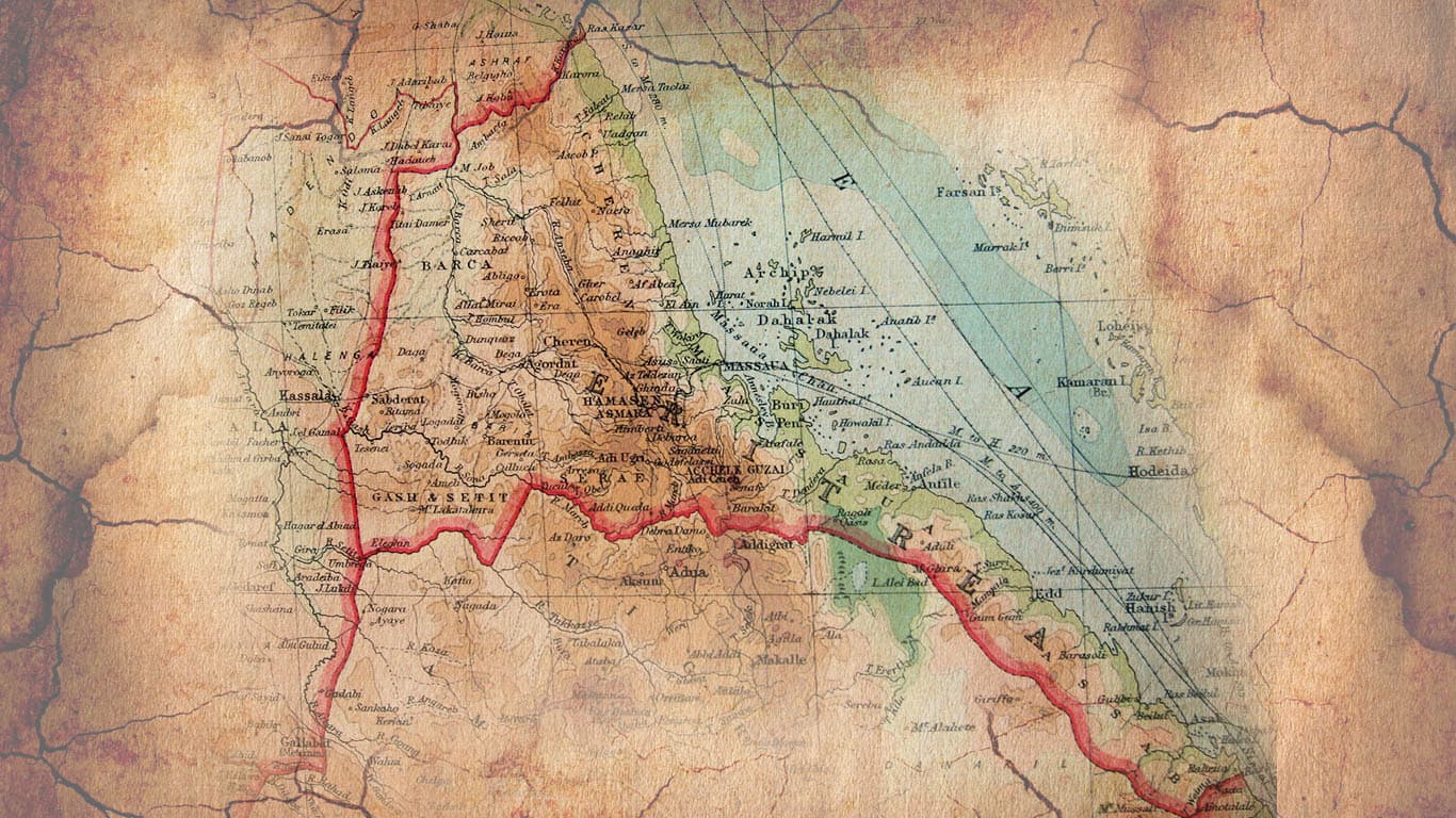
Eritrea
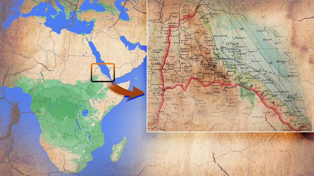
Horn of Africa
Bordered by Sudan · Ethiopia · Djibouti · Red Sea
At a Glance
Quick Facts
Capital
Asmara
Population
≈ 6.3 million
Independence
24 May 1993
Working Languages
Tigrinya · Arabic · English
Currency
Eritrean Nakfa (ERN)
Time Zone
EAT — UTC+3
Highest Point
Emba Soira — 3,018 m
Coastline
Red Sea + Dahlak Archipelago
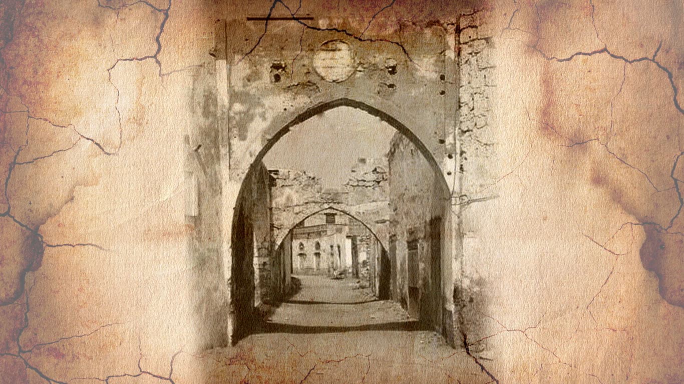
Massawa — Eritrea's ancient Red Sea port
Geography & Climate
Three Worlds in One Country
Eritrea compresses extreme ecological diversity into 117,600 km². The cool highland plateau, the vast western savannah, and the scorched coastal plain each carry their own climate, culture, and way of life.
Central highlands — temperate, fertile plateau averaging 2,300 m.
Western lowlands — vast savannah plains bordering Sudan.
Coastal plain — hot, arid strip along the Red Sea with the Dahlak islands.
Area of ~117,600 km² — roughly the size of England.
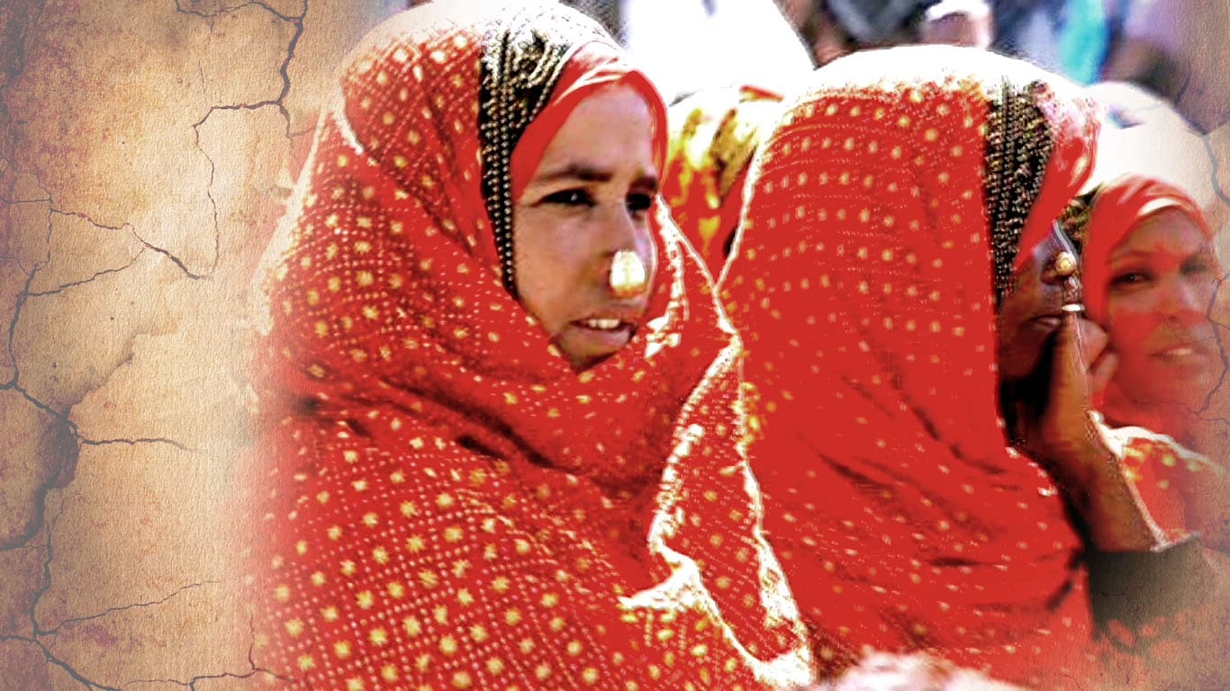
People & Culture
Nine Peoples, One Story
Eritrea's nine ethnic groups speak different languages, practise different faiths, and carry distinct traditions — yet share a history that has forged a singular national identity through struggle and resilience.
Nine recognised ethnic groups; Tigrinya (~50%) and Tigre (~30%) are the largest.
Split almost equally between Christians and Muslims — faiths that have coexisted for centuries.
Coffee ceremony is a daily social ritual — beans roasted, ground, and brewed in one sitting.
Tigrinya is written in Ge'ez script, one of the oldest written alphabets still in use.

A Brief History
Millennia on the Red Sea
From ancient trade empires to a hard-won independence — six eras that shaped the country and its people.
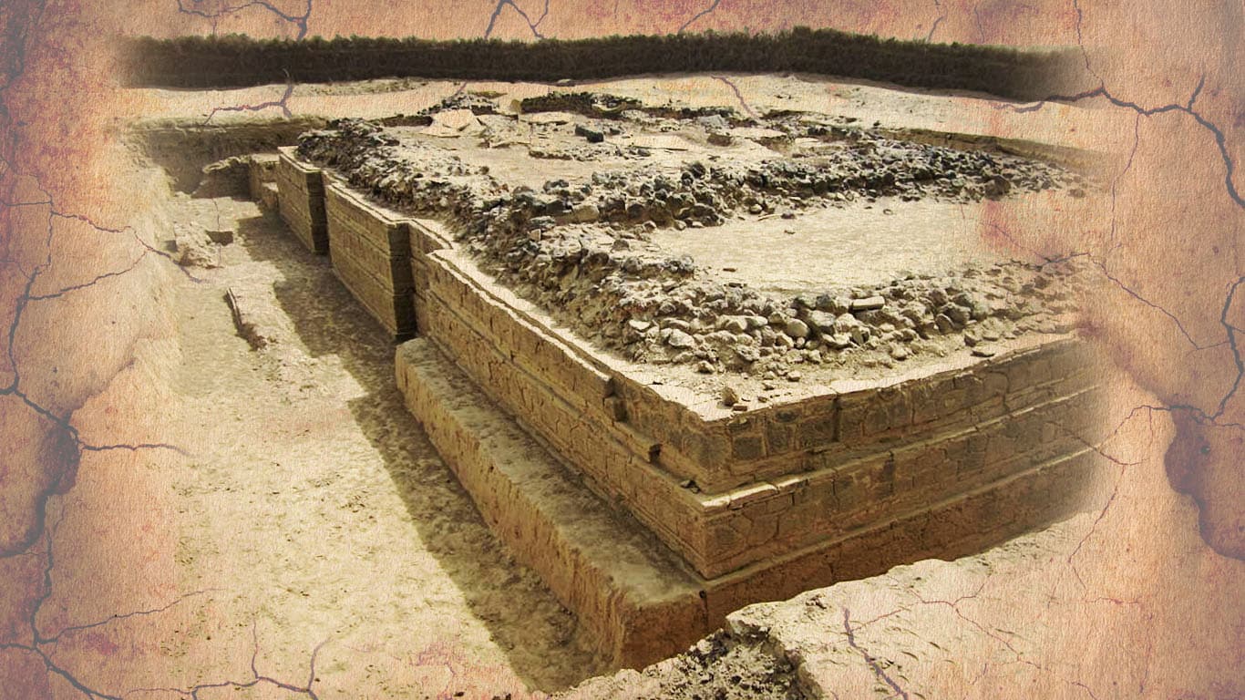
Land of Punt & Adulis
Ancient Eritrea was home to the great port of Adulis on the Gulf of Zula — a gateway linking the Roman Empire, Arabia, and India. Aksumite gold coins and Byzantine mosaics have been excavated there.
Ottoman & Egyptian Rule
The Ottomans seized Massawa in 1557, appointing the Naib to govern the coast. The Egyptian Khedivate later took control, pressing inland. The highland Kingdom of Medri Bahri — ruled by the Bahri Negassi — held its own for centuries.
Italian Colony
On 1 January 1890, Italy declared the Colony of Eritrea — the first time the territory was unified under one name and one administration. Italians built Asmara's art-deco skyline, the mountain railway, and the famous teleferica cable car.
British Administration & Federation
After WWII, Britain administered Eritrea while the great powers debated its fate. In 1952 the UN federated it with Ethiopia — a compromise that satisfied no one. By 1961 Ethiopia had annexed it outright.
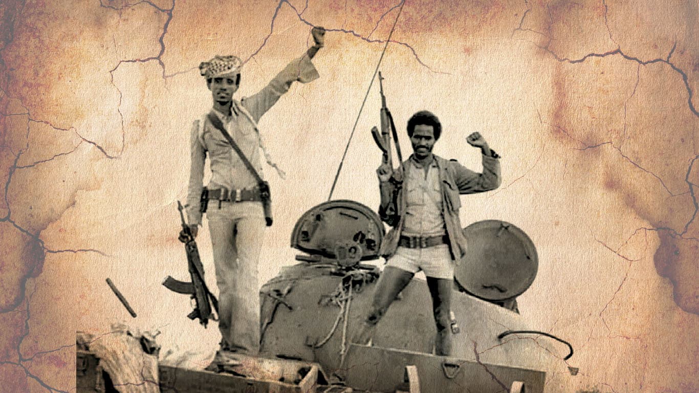
30-Year Liberation Struggle
On 1 September 1961, Hamid Idris Awate fired the first shots of the armed struggle. Thirty years of brutal war followed, first by the ELF, then by EPLF. EPLF's decisive victory at Afabet in 1988 — destroying Ethiopia's Nadew Command — turned the tide irrevocably.
Independence
On 24 May 1991 EPLF fighters entered Asmara. A UN-supervised referendum in April 1993 returned 99.8% in favour of independence. Eritrea formally joined the United Nations on 28 May 1993.
The Capital
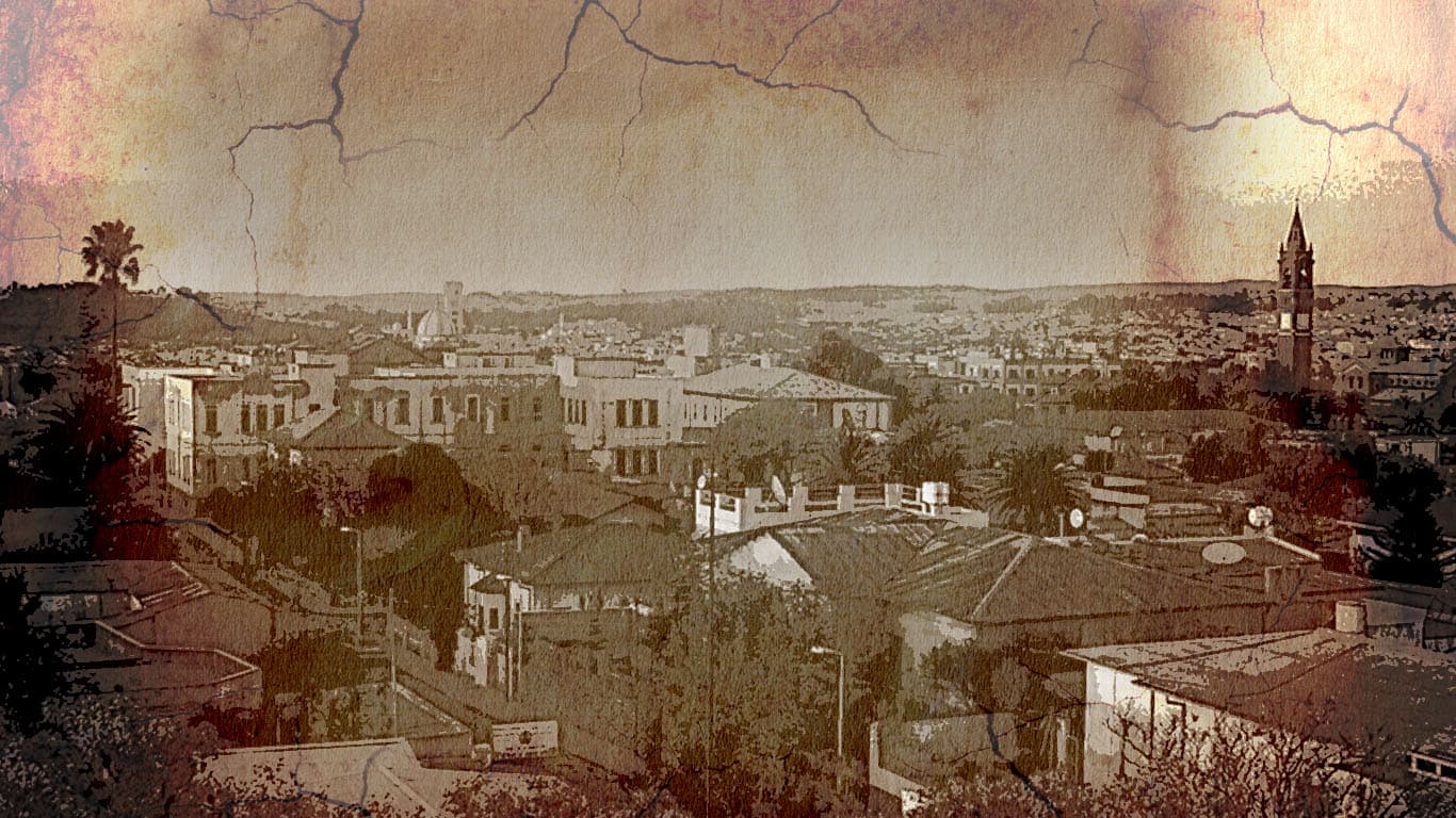
Asmara — Little Rome
Perched at 2,325 m on the highland plateau, Asmara is one of Africa's most architecturally extraordinary capitals. The Italians transformed a market village into a showpiece of Modernist, Futurist, and Art Deco design between the 1930s and 1940s.
The city's wide boulevards, outdoor cafes, and preserved skyline earned it UNESCO World Heritage status in 2017. Locals still call it La Piccola Roma — and they still take their evening passeggiata in the same cafes the colonists built.
Built 1937
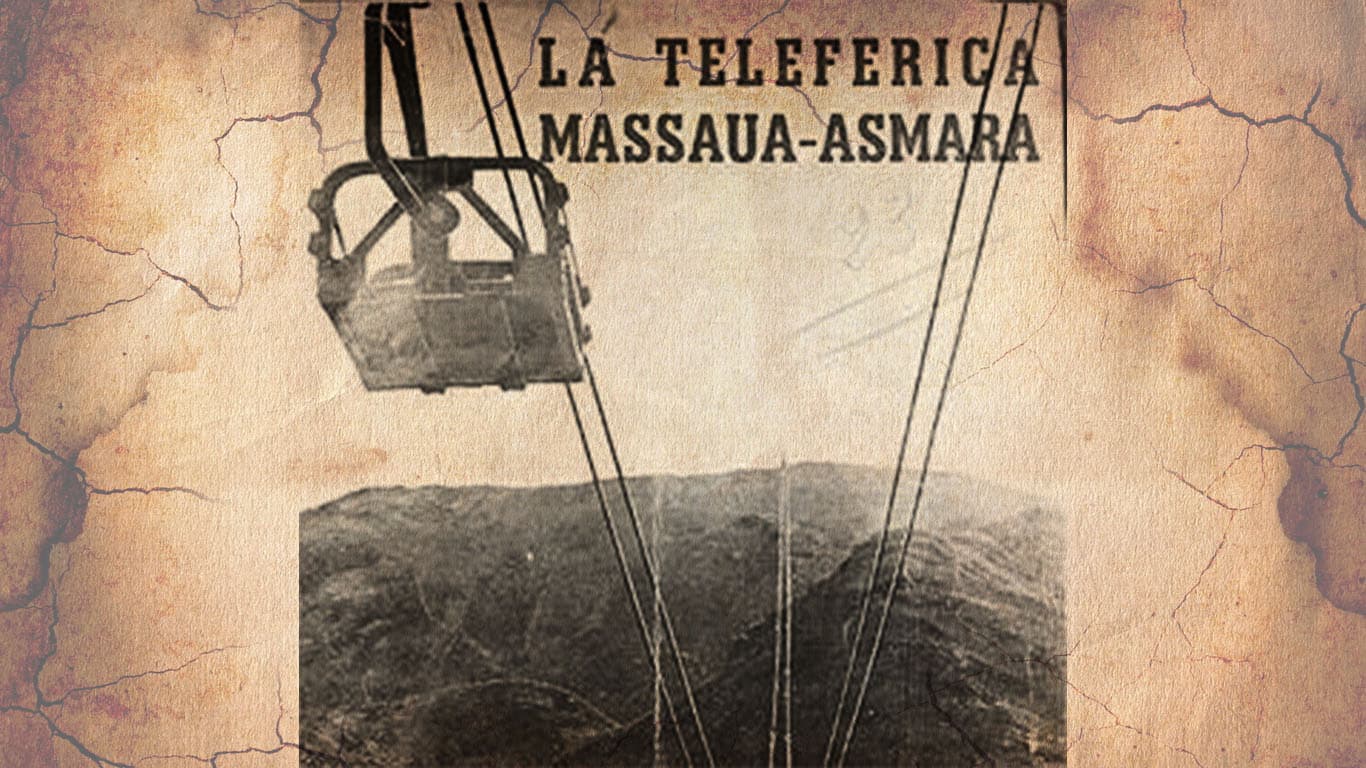
The Teleferica
The Italian-built cable car once carried freight — and people — 75 km down the mountain escarpment from Asmara to Massawa, dropping 2,000 m in altitude. One of the longest aerial tramways ever built.
Did You Know?
Fascinating Facts
Named for the Red Sea
Eritrea takes its name from Mare Erythraeum — the ancient Latin name for the Red Sea, itself derived from the Greek Erythra Thalassa.
Little Rome
Asmara is called "Piccola Roma" — Little Rome — for its extraordinary concentration of Modernist, Art Deco, and Futurist buildings, now a UNESCO World Heritage Site.
Archaeological Eden
Eritrea has over 80,000 recorded archaeological sites — among the highest densities in Africa — from Aksumite ruins to prehistoric rock art.
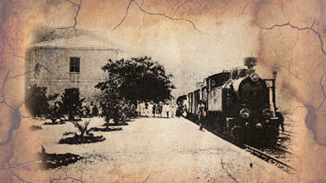
A Railway Still Running
The Eritrean Railway, built by the Italians in 1887–1911, climbs 2,400 m from Massawa to Asmara across 118 km of viaducts and switchbacks. Steam-hauled tourist runs still operate.
No Privileged Language
The Eritrean constitution names no official language. Tigrinya, Arabic, and English are used as working languages — a deliberate choice to honour the country's ethnic and religious diversity.
Nine Peoples
Afar · Bilen · Hedareb · Kunama · Nara · Rashaida · Saho · Tigre · Tigrinya — nine recognised ethnic groups, each with its own language, dress, and tradition.
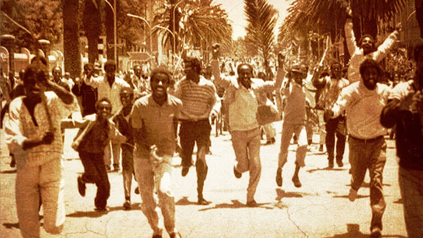
Asmara, 24 May 1991 — Liberation Day
Independence
24 May 1991
"After thirty years of armed struggle, the people of Eritrea were finally free."
When EPLF fighters entered Asmara on 24 May 1991, crowds poured into the streets in scenes of jubilation that had been thirty years in the making. Two years later, a UN-supervised referendum returned 99.8% in favour of independence — and Eritrea formally joined the United Nations on 28 May 1993.
Independence Day is celebrated every 24 May.
Go Deeper
Read the Stories Behind the History
Zantana tells Eritrea's history through the people who lived it — from ancient kingdoms to the liberation struggle and beyond.